





Contest 'Seize the beauty of our Planet' for the best satellite image of Earth
2026 edition: Untouched Wilderness – The Raw Power of Nature

'Seize the beauty of our Planet' contest 2026
The annual international contest ‘Seize the beauty of our Planet’ recognises the most beautiful satellite images of the Earth.
In 2026, CloudFerro, a Copernicus Ambassador, is inviting Earth observation specialists, researchers, data scientists and enthusiasts from around the world to take part in the 7th edition of the contest.
This year’s theme is:
Untouched Wilderness – The Raw Power of Nature
Look at our planet from space and discover places where human presence is minimal and nature remains the dominant force.
From powerful oceans meeting deserted coastlines and vast forests stretching beyond the horizon to active volcanoes, shifting deserts and immense fields of ice, this edition celebrates the power, dynamism and beauty of the natural world.
Show us a place where nature thrives on its own terms.
What are the goals of the contest
Satellite imagery allows us to see landscapes and natural processes at a scale that is impossible from the ground. It reveals the patterns created by water, ice, wind, vegetation and geological forces, and helps us better understand how dynamic our planet really is.
The main goals of the contest are:
Celebrate the beauty and power of our Planet
We want to show extraordinary places where natural forces continue to shape the landscape with little or no visible human influence – from oceans and glaciers to forests, deserts, mountains and volcanic regions.
Raise awareness of the value of natural ecosystems
Remote areas are not empty spaces. Forests, wetlands, glaciers, oceans, deserts and other natural ecosystems play an essential role in the functioning of our planet and in regulating its climate. Seeing them from space gives us a unique perspective on their scale, complexity and vulnerability.
Promote the Copernicus Programme and Earth observation
As a Copernicus Ambassador, CloudFerro aims to promote the use of Copernicus Earth observation data and demonstrate how satellite data helps us observe and understand natural processes across the globe.
Satellite imagery can reveal phenomena that are difficult to perceive from the ground – from glacier movement and ocean currents to vegetation patterns, volcanic activity and changes in desert landscapes.
Find your inspiration
There are countless places and natural phenomena to explore using Copernicus data.
Participants may look for images illustrating, for example:
The Roaring Oceans
Remote islands, uninhabited coastlines, ocean currents, sea ice, tidal patterns and waves meeting dramatic cliffs.
The Indomitable Land
Active volcanoes, mountain ranges, deep canyons, geological formations, salt flats and constantly shifting desert dunes.
The Eternal Green & Ice
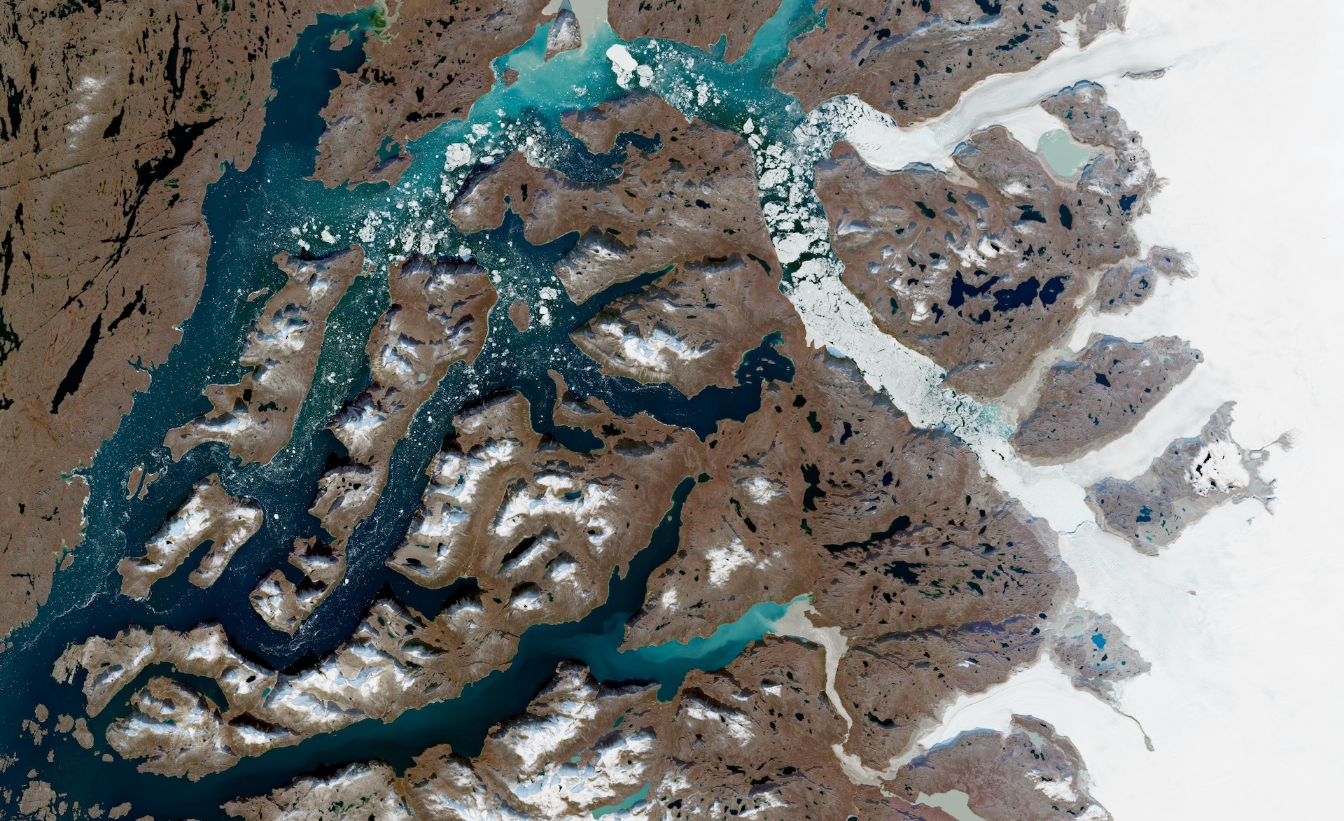
The vast forests of the Amazon and Siberian taiga, remote wetlands, the glaciers of Greenland, the Antarctic ice sheet and other landscapes where vegetation, snow and ice dominate the horizon.
These are only inspirations. Participants are encouraged to explore the Earth and find their own interpretation of the theme.
How to enter the contest and win?
To participate in the contest, generate a satellite image of a place or natural phenomenon that reflects this year’s theme and submit it through the dedicated contest submission page.
The image can be generated using Copernicus Earth observation data available through platforms such as:
- CREODIAS
- Copernicus Data Space Ecosystem
- WEkEO
- CODE-DE-Lab
- or another platform providing Copernicus data.
Satellite data may also be processed and visualised using dedicated software such as QGIS or similar tools.
Not sure how to prepare your image? Watch our tutorial on how to prepare a contest image.
Contest schedule
28 September – 30 October 2026 - Collecting contest entries
02 November – 10 November 2026 - Phase 1 – public voting to select the finalists with the highest number of votes
11 November – 17 November 2026 - Phase 2 – Jury voting to select the three top entries from among the finalists chosen in the public vote
18 November 2026 - Winners announcement
How are the winners selected?
The 12 images with the highest number of votes in the public voting phase will become finalists and proceed to the second phase of the competition.
In the second phase, a Jury composed of Earth observation experts will select the three best entries.
The winning images and the remaining finalist images will be featured in the CloudFerro calendar for 2027.
What are the prizes?
The authors of the three images receiving the highest number of Jury votes will receive special prizes:
1st place – Apple iPad 11" 11gen
2nd place – Apple Watch Series 11 GPS 42mm
3rd place – Apple AirPods Pro 3
The authors of the finalist images will receive a unique CloudFerro wall calendar for 2027 featuring the winning satellite images.
Participants whose entries are accepted to the public voting phase will receive a CloudFerro desk calendar.
Image requirements
- The satellite image submitted to the contest should depict a location or natural phenomenon corresponding to the 2026 theme “Untouched Wilderness – The Raw Power of Nature”.
- The image should be based on Earth observation data available through an EO platform such as CREODIAS, Copernicus Data Space Ecosystem, WEkEO, CODE-DE-Lab or another platform providing Copernicus data.
- Satellite data may be visualised and processed using software of the participant’s choice, such as QGIS, to highlight the natural structures or phenomena shown in the image.
- The image must meet the minimum technical requirement of 250 dpi and 6500 × 5000 pixels and should not exceed 8000 px.
- Each contest entry must include:
- title of the image,
- description of what the image depicts,
- location,
- explanation of why the participant selected this particular place or phenomenon,
- name of the satellite / source data,
- date or year of satellite observation.
- Only ONE image may be submitted by each contestant.
- Images may be enhanced using Earth observation or photo-editing software but must NOT contain text, labels, logos or other additional graphic elements.
Where to generate the contest image
Participants can use platforms providing access to Copernicus Earth observation data and tools, including:
CREODIAS
A European Earth observation platform providing access to Copernicus satellite data together with cloud computing resources and tools enabling users to search, view and process satellite products.
Copernicus Data Space Ecosystem
The main environment for accessing data from the Copernicus Earth observation programme, providing discovery, visualisation, download and processing capabilities for Copernicus data and other Earth observation collections.
https://dataspace.copernicus.eu/
WEkEO
A European platform providing access to Copernicus environmental data and information, including data from the Copernicus Sentinels and Copernicus Services, together with tools and computing environments for data processing.
CODE-DE-Lab
CODE-DE-Lab is the German Earth observation platform providing access to Copernicus and other satellite data, cloud-based processing resources, and tools supporting public institutions, research organisations and companies working with Earth observation data and applications.
Other Copernicus data platforms
Entries may also be generated using other platforms providing access to Copernicus data, provided that they comply with the contest requirements.
Why the theme of the raw power of nature?
From orbit, the scale of the natural world becomes visible in a completely different way.
Ocean currents create enormous patterns stretching across hundreds of kilometres. Rivers reshape deltas and coastlines. Wind constantly redraws desert dunes. Volcanoes build new land. Forests form immense living structures, while glaciers move slowly across entire regions.
These landscapes remind us that Earth is not a static background to human civilisation. It is a dynamic system shaped by forces operating across enormous spatial and temporal scales.
Earth observation gives us the unique ability to see these processes, study them and follow how they change.
In the 2026 edition of ‘Seize the beauty of our Planet’, we invite you to explore this perspective.
Search the Copernicus data archives. Find a place where nature dominates the landscape. Experiment with bands, indices and visualisation techniques.
And show us the raw power of our Planet as seen from space.
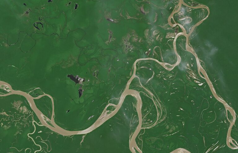
Amazon River. Contains Copernicus Sentinel-2 modified data (2026).
About the Copernicus data
Satellite observations play a key role in efficient and cost effective monitoring of the Earth ecosystems, and remote sensing techniques prove highly beneficial in this area. The European Copernicus Earth Observation programme provides data that has many attributes, spectral and spatial ones, about oceans, lands and atmosphere. They provide us with resources for environmental analysis in all dimensions, from local to global and from visible to radar techniques.
Scientists have developed various indices like NDVI, NDWI, and SMI, which are essential tools for Earth observation. NDVI measures vegetation health by comparing near-infrared (NIR) and red visible light wavelengths. NDWI, or Normalized Water Index, indicates water body extent and reflects biomass water content, commonly used in water management. The Soil Moisture Index (SMI) estimates soil moisture content using Sentinel-1 radar data. Additionally, SWIR or NIR data can help assess land dryness, vegetation coverage, and map extreme events like wildfires or flash floods.
By organising the contest we want to promote the use of satellite imagery that is a vital tool for understanding processes taking place on Earth on a larger scale, offering global coverage and instant access to accurate data.
Please contact us at communication [at] cloudferro.com for any questions that you may have. We will be happy to help you.
The details of the contest can be found here: Terms and Conditions (PDF).